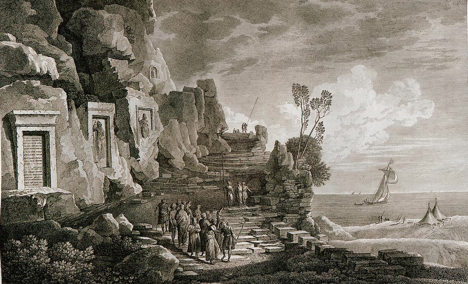
Drive north out of Beirut at rush hour and Dbayeh passes in a blur of towers, malls, and a marina. Within a short walk of the highway, Ramesses II, Assyrian kings, a Roman emperor, a Mamluk sultan, and WWI and II soldiers have all left their mark. Few places in Lebanon compress so much of the country’s past into so little ground, and few are passed so quickly.
The town itself is young. It took its present shape between 1870 and 1930, when four older localities grew into one: Dbayeh, whose name means the gazelle in Lebanese Arabic; Zouk el-Kharab; Haret al-Ballaneh, named after the ballan, the thorny burnet that covers the coastal hills; and Awkar, a name that refers to water. Its territory reaches north to the cape of Nahr al-Kalb, the Dog River, and the ground it covers bears witness to almost every period of Lebanese history, from prehistory to the present day.
Lebanese historical discourse has long favoured grand national narratives, many of them built on fictional constructions, selective interpretations, and competing ideological agendas. These narratives flatten a complex past and push ordinary people and communities to its margins. Local history offers an alternative. It studies the past within a bounded place, whether a district, a town, a village, or a neighbourhood, and connects the immediate experience of the people who lived there to the wider history of the country. At this scale the historian can document lived experience and reconstruct everyday life. Dbayeh offers a case in point. How can a single town tell the story of Lebanon from its own angle, and what can its past teach us about building a shared history of the country from local ones?
The answer begins with the landscape. At Nahr al-Kalb, the limestone of western Mount Lebanon drops almost vertically into the Mediterranean, leaving only a narrow ledge between cliff and sea. Behind it, the porous rock of the mountain feeds the karst springs near the Jeita Grotto, where the river begins its thirty-one-kilometre course to the coast. Every traveller, merchant, and army moving along the Levantine shore had to squeeze through this passage.
People found shelter here early. Two caves on the cape preserve traces of human activity going back some 300,000 years, among the oldest evidence of human presence in Lebanon. Much later, the cape became a place where power wrote itself into stone. For ancient rulers, a promontory imposing enough to block the coastal road carried natural associations with sacred and political authority, and each empire that controlled the coast felt compelled to record its passage there.
Drive north out of Beirut at rush hour and Dbayeh passes in a blur of towers, malls, and a marina. Within a short walk of the highway, Ramesses II, Assyrian kings, a Roman emperor, a Mamluk sultan, and WWI and II soldiers have all left their mark. Few places in Lebanon compress so much of the country’s past into so little ground, and few are passed so quickly.
The commemorative inscriptions on the rock face run from Ramesses II in the thirteenth century BC to 2000, and UNESCO has inscribed them on its Memory of the World register. Egyptian hieroglyphs, the Akkadian cuneiform of Assyrian and Neo-Babylonian kings, Latin, Greek, Arabic, English, and French stand side by side on the same cliff, a timeline of empire and memory carved directly into the mountain.
The river’s names carry the same layers. Greek and Roman writers called it the Lykos, the river of the wolf, and a Latin inscription from the reign of Caracalla records the road widened along its cliff. Arabic tradition later renamed it Nahr al-Kalb, the river of the dog, and legend explained the change through a statue that howled to warn Beirut whenever an invading army approached. The Roman presence reached beyond the cliff. Until recently, two Roman necropolises crowned two hills in Dbayeh, evidence of a small village nearby. Both were destroyed during the unregulated construction of the past decade, a sign of how fragile the material record of local history remains.
The howling statue had reason to sound its alarm. In October 1100, Baldwin of Boulogne, count of Edessa, fought his way through an ambush laid at the river by Duqaq, the Seljuk emir of Damascus. The victory opened the coastal road south, and that Christmas Baldwin was crowned the first king of Jerusalem. Once the County of Tripoli took shape a few years later, the river came to mark the northern edge of his kingdom. Seen from this cliff, the Lebanese past appears as a long sequence of passages: empires came, carved their names, and moved on.
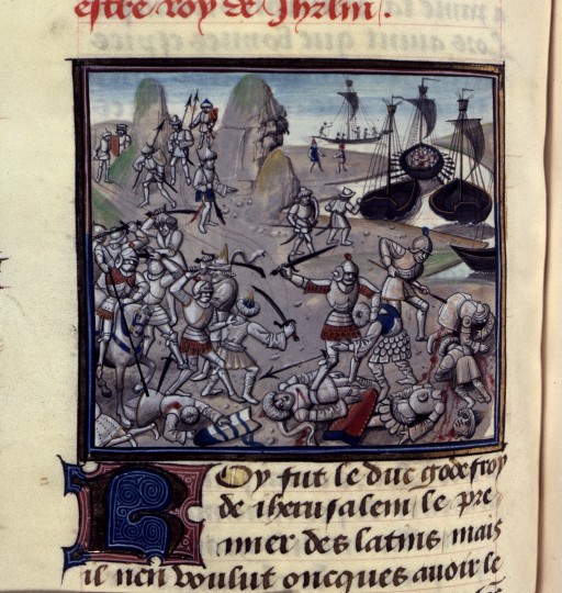
Battle of Nahr el-Kalb, William of Tyre, Historia and continuation (BNF Richelieu French manuscripts 68, folio 125v)
As Crusader power faded, the Mamluk sultanate set out to secure Kisrawan, the highlands of central Mount Lebanon whose position between Damascus, the Bekaa, and the coastal cities made them strategically indispensable. A series of punitive campaigns culminated in 1305 with an expedition that devastated the region. To hold the coastal road and watch over the mountain, the Mamluks installed a Turkoman clan known as the Awlad al-A’ma, the sons of the blind man. The clan made the Nahr al-Kalb promontory its headquarters, occupied an earlier Crusader tower there, and established the Zouks, a name often traced to al-azwak, the watch points.
The name of their muqaddam, or headman, survives in Zouk el-Kharab, one of the four localities that would later form Dbayeh. The clan went on to found the Assaf emirate and moved its seat to Ghazir, yet its imprint on the coastal toponymy remains legible seven centuries later.
Under Assaf protection, Maronite peasants established the small agrarian hamlets of Zouk el-Kharab, Haret al-Ballaneh, and Awkar. Their names still describe the land they found: a hillside of thorny burnet, a place of water. A small cave church in the hills, Saydet al-Maghara, Our Lady of the Cave, venerated as the patroness of herdsmen, probably dates from this period and recalls the pastoral life of these first settlers. The Assafs ruled the area into the early Ottoman period, until the Sayfa emirs of Akkar ended the dynasty in 1590.
In 1600, Nahr al-Kalb once again decided the fate of the mountain, when Emir Fakhr al-Din II defeated the Sayfa at the river and extended his authority northward into Kisrawan. His partnership with the Maronites, a Druze ruling house allied with a Christian mountain population, later became a cornerstone of the national narrative, which cast him as the founder of Lebanon. Historians such as Salibi and Abu Husayn have shown how much of that image was built after the fact. Local history offers a way to test such claims. Seen from Dbayeh, the battle appears as one episode in a long contest among regional lords for a strategic coastal road, fought within the Ottoman order of the day.
The emirate later passed from the Ma’nids to the Shihabis. After the Battle of Ain Dara in 1711, the land between Beit Chabab, Dbayeh, and Antelias was granted as an iqta’ to the Abi al-Lama’ emirs and joined the Matn districts under the name al-Qate’, the segment. The eighteenth century then left its mark in stone. Around 1746, the old watchtower on the promontory was absorbed into a new Maronite monastery, Saint Joseph of the Tower. In 1768, Zouk el-Kharab built its church of Saint George, distinguished by the ablaq stonework of its windows and gate, beside the remains of an undated church of Mar Elias that may be older still.
The nineteenth century brought the first mention of Dbayeh itself, which appears on maps of the period as a khan on a sparsely inhabited plain between Zouk el-Kharab and Awkar. The khan was probably built along a new road commissioned by Emir Bashir II Shihab, who also restored the bridge that still spans the valley of Nahr al-Kalb today.
The surrounding villages were caught up in the upheavals of the age. In 1858, as the peasants of Kisrawan rose against their feudal lords, Zouk el-Kharab briefly served as a support base for the Khazin sheikhs in a period where the sheikhs were expelled from Kisrawan.
The transformation that created the modern town came from an unexpected direction: water. In the most literal sense, Dbayeh owes its existence to the growth of modern Beirut. The Mount Lebanon Mutasarrifiyya, established in 1861 after the French expedition sent by Napoleon III, whose inscription also stands at Nahr al-Kalb, brought a stability that drew mountain families toward the coast. Beirut was growing into a modern port city, it needed water, and Dbayeh lay directly on the route that water would travel.
In 1873, Sultan Abdülaziz granted French, British and Belgian investors the concession to channel water from Nahr al-Kalb and the Jeita springs into the city. In 1896 a pumping and treatment station rose at Dbayeh–Zouk el-Kharab, and a new bridge connecting Beirut to Tripoli through Nahr el-Klab was built by the governor of Mony Lebanon Naoum Pasha in 1901. In 1909, a French consortium that included the bank later absorbed into BNP Paribas acquired the company and reorganised it as the Ottoman Beirut Water Company, which held the concession until it passed to the Lebanese Republic in 1951.
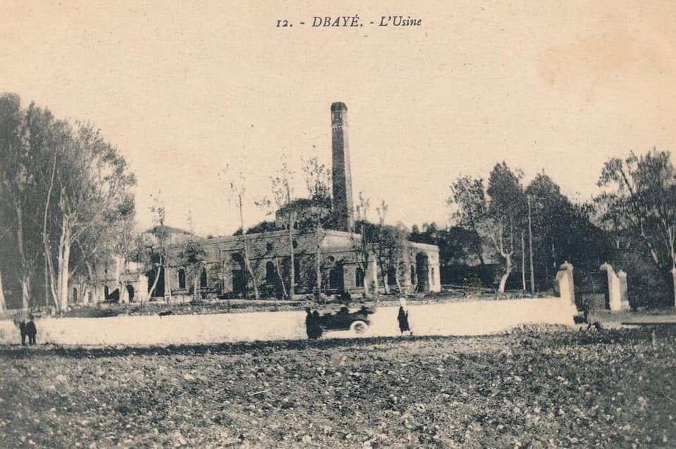
Dbayeh’s Water Station-1900
The water works drew people. Investing families arrived from Beit Chabab, Mazraat Yachouh, and the Batroun region, formed a kind of consortium around the water company, and brought farmers down from the mountain to work the land. The empty plain between the older villages was soon converted into citrus and banana orchards, and by 1889 its growing community had a parish of its own by the sea, also dedicated to Saint George, patron of the coast, and distinct from the older church of Zouk el-Kharab. The opening of the station had turned these scattered beginnings into a town.
The young community even acquired a Levantine dimension, as an Italian family settled among the founding families and married into them. Social differences were written into the houses. The founding families built Beiruti-style homes with red-tiled roofs, while the sharecroppers lived in marabi’in, the small two-storey tower-houses typical of the coastal plain.
By the turn of the century, Dbayeh had become a favourite weekend outing for Beirut’s well-to-do, who came to admire the artificial waterfalls built by the water company, visit the inscriptions at Nahr al-Kalb, and dine at the restaurants and small hotels that opened along the road. A railway linking Beirut to Maamaltein in 1905, with a stop at Dbayeh, tied the town more closely to the rhythms of the capital. The First World War slowed this momentum, though the town’s relative prosperity spared it the worst of the famine that devastated much of the mountain.
Local history matters because it brings the past down to a human scale. At the level of a town or a neighbourhood, the historian can follow individual lives, families, and places, set grand narratives against lived experience, and return to communities the capacity to interpret their own past.
The political upheavals of the twentieth century reached Dbayeh through its administration and through its cliff. By 1920 the town belonged to the newly proclaimed State of Greater Lebanon under the French Mandate, and by 1926 to the Lebanese Republic. The rock face had already recorded the end of Ottoman rule in 1918 and the French victory at Maysaloun in 1920. In 1941, the brief Vichy period left fortifications in the mountain and anti-tank defences along the beach, until Allied and Free French forces took the position and added their own stele. The following year, Australian engineers brought the coastal railway through the cape, and a stele bearing the image of the wolf-dog, an echo of the river’s ancient name, marked the occasion.
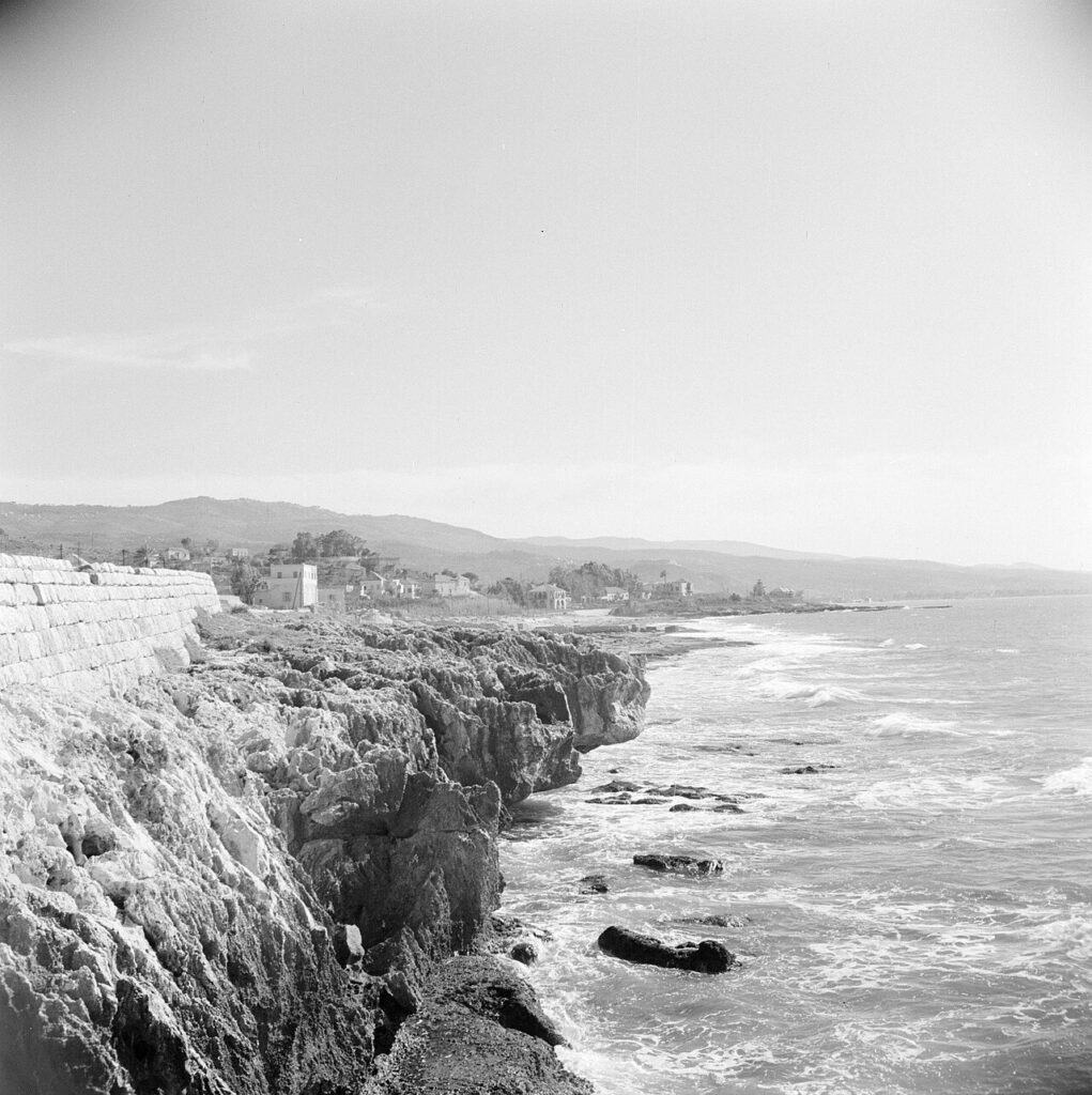
Dbayeh’s coast, 1955, picture by Dutch photographer Van De Poll.
The 1950s gave Dbayeh a gentler identity. Its wide sandy beach and the natural pool known as Birket al-Sett, the lady’s pool, made it a popular summer destination. In 1952, the town also received a camp for Palestinian refugees, most of them Christian, built on land belonging to the Maronite Church. Dbayeh obtained its first municipality in 1961, as part of the Shihabist effort to modernise the state’s institutions. The calm proved fragile. After the 1969 Cairo Agreement granted armed Palestinian factions autonomy over the camps, the camp slipped increasingly beyond the reach of Lebanese authority, and armed incidents and checkpoints became part of daily life around it in the years leading up to 1975. The civil war reached the town in January 1976, following constant attacks of Palestinian armed groups from the camp, Christian militias laid siege to it, then home to some fifteen hundred refugees. The camp fell two days later. For the rest of the war Dbayeh remained comparatively stable, while it steadily lost a generation of educated young people to emigration.
Following the April 1983 terrorist suicide bombing of the U.S. Embassy in Beirut, the Embassy relocated to Awkar, on the heights above Dbayeh, where a second terrorist bombing in September 1984 struck its new compound. Temporarily closed in 1989, the Embassy reopened as the war came to an end in 1990 and remains in Awkar to this day.
The town suffered most in 1990, when it became a front line in the intra-Christian war between the Lebanese Forces and the army units loyal to General Michel Aoun.
Peace brought a transformation of a different kind. After the Taif Agreement, new highway infrastructure consumed Dbayeh’s beach to widen the approach to Beirut, and what remained of the shoreline was reclaimed to create the Marina. Hotels and real-estate investment followed, and within a generation Dbayeh became one of Beirut’s fashionable northern suburbs. The price was high. The town lost its sandy beaches, and the archaeological site at Nahr al-Kalb, its oldest and most singular asset, suffered serious and largely irreversible damage, part of which has recently been linked to construction on the site by the Free Patriotic Movement for its headquarters.
Local history gives the national past a ground to stand on. In Dbayeh, it anchors the passage of empires, the founding myths of the emirate, the birth of modern Beirut, and the wounds of the civil war in specific places, and it restores the people who lived through them. It also returns history to the communities that carry it. Dbayeh’s municipality is already using social media to raise awareness of the town’s past while it awaits a national programme to rehabilitate the Nahr al-Kalb site.
Every town, village, and neighbourhood in Lebanon holds parish registers, family papers, photographs, deeds, and the memories of its elders, and much of this material is disappearing faster than anyone is studying it. A history of Lebanon assembled from hundreds of such local histories would be richer than the single, flattened narrative we have inherited.
Local history matters because it brings the past down to a human scale. At the level of a town or a neighbourhood, the historian can follow individual lives, families, and places, set grand narratives against lived experience, and return to communities the capacity to interpret their own past. Its sources, however, are fragile: deeds, photographs, parish registers, and the memories of elders disappear with each generation. Municipalities can establish local archives, schools can train students to collect oral histories, and parishes can open their registers to archivists and historians. Families, too, can preserve what they hold. A critically researched history of Lebanon will rest on these local foundations, and the next time we pass the cliff at Dbayeh, we might read in its inscriptions an invitation to begin.
Charles al-Hayek is a public historian and the founder of Heritage and Roots.
The views in this story reflect those of the author alone and do not necessarily reflect the beliefs of NOW.